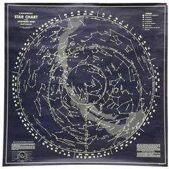
1950s Chalkable Northern Sky Star Map
View Similar Items


1 of 6
1950s Chalkable Northern Sky Star Map
About the Item
- Dimensions:Height: 44 in (111.76 cm)Width: 44 in (111.76 cm)Depth: 0.01 in (0.26 mm)
- Style:Mid-Century Modern (Of the Period)
- Materials and Techniques:
- Place of Origin:
- Period:
- Date of Manufacture:1960
- Condition:outer paper is missing in the top right corner. Please see image 5.
- Seller Location:Portland, OR
- Reference Number:1stDibs: LU79065143233
You May Also Like
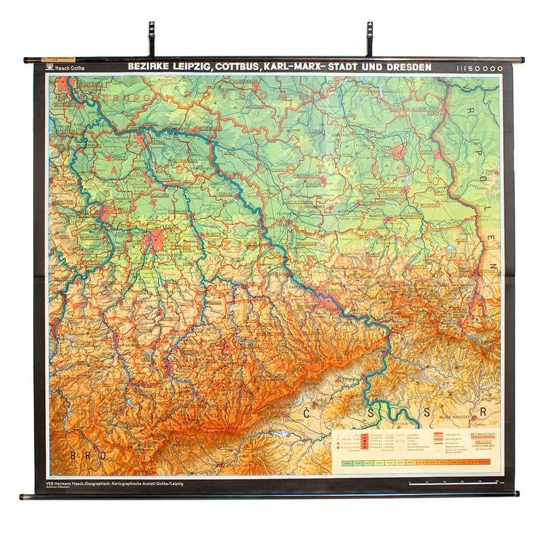
- East German MapBy VEB Hermann HaackLocated in Baltimore, MDA brilliantly colourful map of the Leipzig, Karl Marx Stadt and Dresden area in the former German Democratic Republic by VEB Hermann Haack of Gotha.Category
Vintage 1970s German Maps
 $295 Sale Price25% Off
 - Star WarsLocated in London, GBOriginal Japanese film poster this unique design was used for the films Japanese release of the film. The art work is by Seito (dates unknown). This poster is unfolded and conserva...Category
Vintage 1970s Japanese Posters
MaterialsPaper
 $946
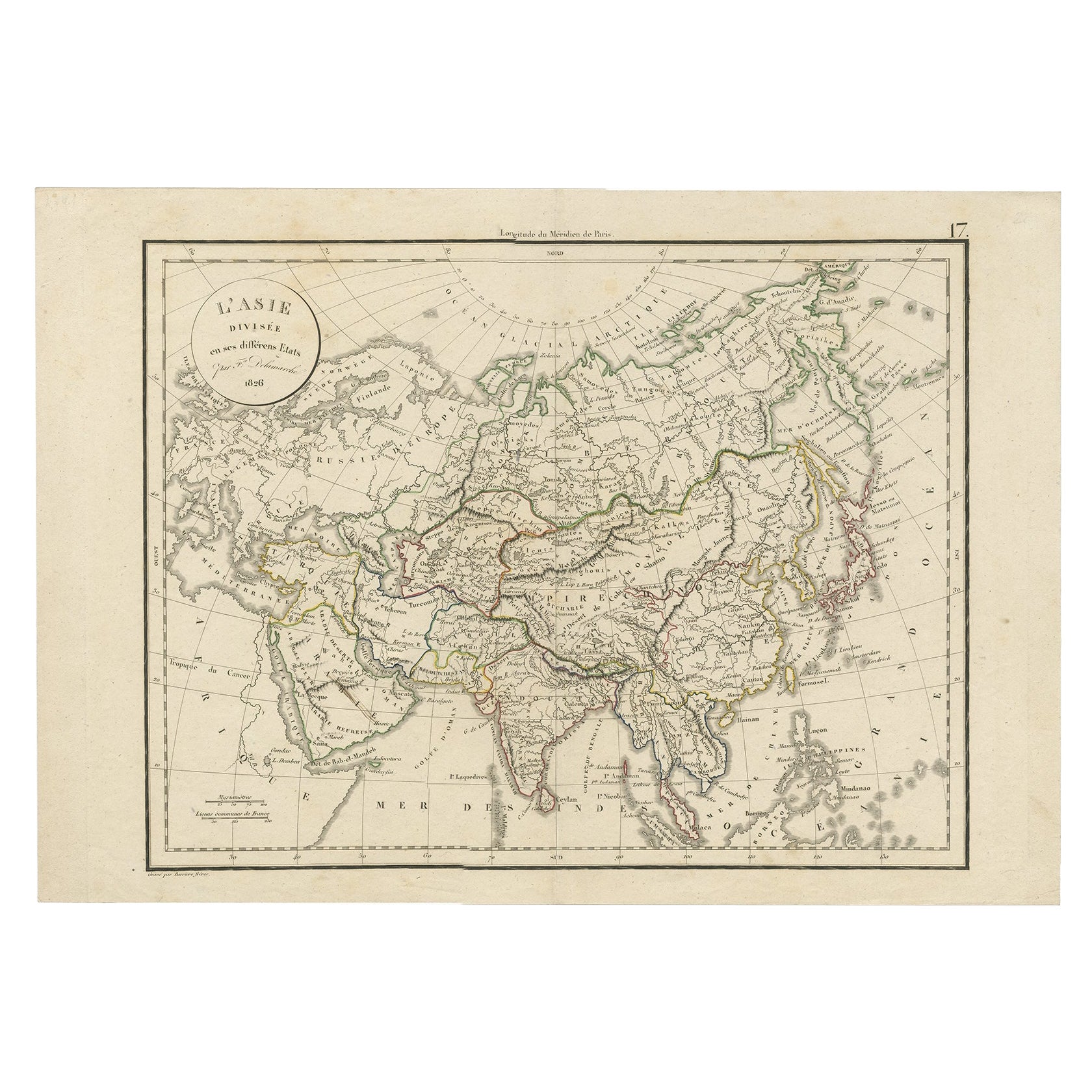
$946 - Antique Map of Asia by Delamarche, 1826Located in Langweer, NLVaugondy's map plates and copyrights and later addes many plates from other sources as well. Charles Delamarche eventually passed control of the firm to his son Felix Delamarche (18t...Category
Antique 19th Century Maps
MaterialsPaper
- Star Wars The Magic of MythLocated in London, GBOriginal American poster for an exhibition titled Star Wars: The Magic of Myth held at The Field Museum Chicago on the 15th July 2000-7th January 2001 This poster is conservation li...Category
21st Century and Contemporary American Posters
MaterialsPaper
- Gilt Framed Vintage Wine Regions of France MapLocated in Alton, GBFramed French wine region map 1973. The print has been removed to clean the glass, the frame has minor damage in places but nothing that detracts from ...Category
Vintage 1970s French Posters
MaterialsPaper
- Large University Chart “Physical Map of Africa” by BaconLocated in Chillerton, Isle of WightLarge university chart “Physical Map of Africa” by Bacon W&A K Johnston’s Charts of Physical Maps By G W Bacon, This is colorful Physical map of North America, it is large lithograph set...Category
Early 20th Century Folk Art Posters
MaterialsLinen


Recently Viewed
View AllMore Ways To Browse
Framed Vintage Maps
Vintage Volkswagen
Godzilla Poster
Kling Furniture Vintage
Patriotism Posters
Job Cigarettes
Hawaiian Vintage Posters
George Ham
James Bond Us Movie Posters
Robert Duvall
Roosevelt Posters
Vintage French Ad Posters
Vintage Horror Posters
Air India Retro Posters
2 Foglio
Alice In Wonderland Poster
Vintage Campari Poster Original
Gran Premio